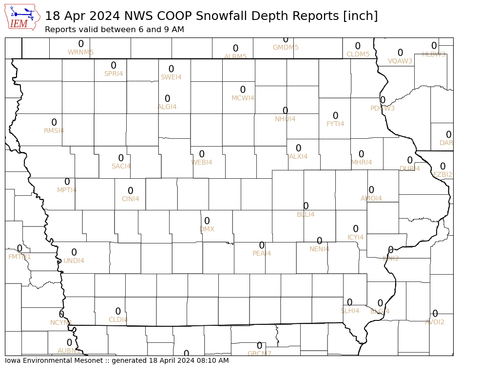
Most of the snow is working its' way out of the area, eastern as well as parts of northern Iowa may see some moderate snow before Noon still. Other parts of the states may see flurries for the most part, with not much more accumulation. Throughout the night the snow fell over the state, with very localized amounts being heaviest as banding of snow was once again the culprit for the high snow amounts. This is easily noticeable while looking at the latest COOP snowfall maps, streaks of 6-8 inch amounts next to some of the lighter amounts.
Expect temperatures in the mid 20s on average and lows anywhere from the single digits to mid-teens dependent on cloud cover overnight. Thus, the lower temperatures for lows seem to be forecast on Monday night as well as Wednesday night for the beginning of this week. The next system looks to come into the state on Tuesday night/Wednesday, but currently is not expected to be too strong. Winter has seemingly made its' way into the area finally and should stay for quite a while, at least the frigid arctic air is not in place at this time.
Here is the snowfall depth currently over hour, updated daily:
Husband, Father, & Meteorologist.
Randomness of family, rural Kansas life, weather, climate, photography, & household projects.
Menu
Widgets
Social Links
Search
About
Blog Archive
-
▼
2007
(204)
-
▼
January
(15)
- Afternoon Snow & Arctic Air
- New Equipment!!
- Weekend Storm #2 Totals
- Weekend Storm #2
- Welcome to the Iowa Chaser Blog!!
- New Website Design!
- Weekend Snowstorm (Final Report)
- Weekend Snowstorm (Update #4)
- Weekend Snowstorm (Update #3)
- Weekend Snowstorm (Update #2)
- Weekend Snowstorm!
- Spring Semester Begins!
- Snowstorm No More???
- Next Snowstorm...
- New Year’s Eve Snowstorm
-
▼
January
(15)
Popular Posts
-
My wife & I needed a new mattress as we were sleeping on one that was at least 15 years old. She has always wanted to get a king size be...
-
A strong shortwave and associated vorticity maxima is currently located over extreme northeast Kansas and northwest Missouri. This shortwave...
-
Numerous clusters of thunderstorms continue across portions of the Central and Southern Plains tonight, with a continued risk of a few sever...
-
In what will be a ritual for the rest of the football season, here is my ‘official’ forecast for the Iowa State vs UNLV football game that ...
-
Mild temperatures and an ambitious brother-in-law meant the opportunity to continue the cleanup of Cedar trees in the rear of the property. ...
Powered by Blogger.


0 comments:
Post a Comment