Wednesday, January 31, 2007

Afternoon Snow & Arctic Air

Snow showers worked their way across the state this afternoon and still are as we work our way towards the evening. Some areas of the state only saw snow flurries for an hour or two, while other areas have seen snow for most of the afternoon. Here in Ames, it has been snowing since around 11:30 AM and is still continuing as I type. The snow has been moderate at times, although light snow has been the main explanation for the most part. Only minor accumulations have been seen across the state and that is all that is expected throughout the rest of the evening as the snow tapers off for most of the state.

Following this shot of snow will be another small system for Thursday night into Friday. This system will once again bring small snow amounts just like this one did, although winds will be much higher and thus the risk of blowing snow is in the forecast. Along with the next system, the arctic air looks to follow with highs across the state going from lower 20s and upper teens tomorrow down to the single digits on Friday with only a few locations reaching double digit highs. The highs in the single digits are likely to continue through Tuesday next week, the coldest days are likely over the weekend where on Saturday the highs are currently forecasted to be in the single digits below zero in much of the state!! Lows during this time will be well below zero, with some areas in northern Iowa attempting to approach -20 for a low. These frigid temperatures combined with even the slightest winds will likely cause wind chills near the -30 mark or lower. This is a dangerous combination, with even minutes of exposure to those temperatures and frostbite can occur. Warm-up does look to happen by mid-week next week, I'm sure temperatures even near 20 will have most people thankful after this weekend!
Monday, January 29, 2007

New Equipment!!

If you haven't noticed the new lists on the right featuring 'Equipment Owned', etc. this is the post to tell you about my new equipment! This weekend I went home to pick up my new camera, Canon Rebel XTi as well as the CF card and my two lenses that I currently own for the camera. The first lens is the usual kit lens which I got with the deal basically for nothing and the second one is my zoom lens from Sigma.

More details on the kit lens; 18-55mm with f/3.5-5.6 aperture. This lens I have used before while borrowing the XT from Iowa State, I wasn't greatly impressed, but I wasn't displeased and thus for now this lens will do for my portrait and wide angle shots of landscape.

The Sigma lens is something that I'm looking forward to using and getting used too. It's the latest from Sigma, the APO DG Macro lens that goes from 70-300mm and thus is a great range of zoom that I can use for various things. The aperture ratings on this lens go from f/4-5.6 and as noted in the name also has a macro feature on it. I haven't done anything with the macro feature to see how effective it is, but I doubt I will use it too often anyway and thus wasn't a huge influence on buying this lens. I tested this lens over the weekend at a wrestling tournament, I was pleased with several of the pictures that I had proper focus on. Others were quite close to having good focus, but while zooming at the 200mm level or greater the focus can be quite touchy, especially with such quick moving objects and so many of them. I hope to get a few of those images up later in the week along with some images of the ducks/geese that I plan on taking on Thursday.

That's all I really have for now, within the next months I will accumulate a tripod, a remote shutter as well as other accessories for the camera. Look for lots of new images from me as I continue to test out the camera and lenses. These pictures will hopefully be featured on my 'gallery' pages that I'm working on at the moment... Always busy updating things, I can never be happy with what I come up with, always thinking bigger and better!

Sunday, January 21, 2007

Weekend Storm #2 Totals

Most of the snow is working its' way out of the area, eastern as well as parts of northern Iowa may see some moderate snow before Noon still. Other parts of the states may see flurries for the most part, with not much more accumulation. Throughout the night the snow fell over the state, with very localized amounts being heaviest as banding of snow was once again the culprit for the high snow amounts. This is easily noticeable while looking at the latest COOP snowfall maps, streaks of 6-8 inch amounts next to some of the lighter amounts.

Expect temperatures in the mid 20s on average and lows anywhere from the single digits to mid-teens dependent on cloud cover overnight. Thus, the lower temperatures for lows seem to be forecast on Monday night as well as Wednesday night for the beginning of this week. The next system looks to come into the state on Tuesday night/Wednesday, but currently is not expected to be too strong. Winter has seemingly made its' way into the area finally and should stay for quite a while, at least the frigid arctic air is not in place at this time.

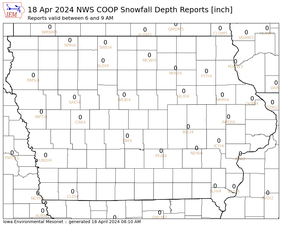
Here is the snowfall depth currently over hour, updated daily:


Saturday, January 20, 2007

Weekend Storm #2

6 PM Update: Off-hour model runs' this afternoon showed an increasing potential for significant snow across portions of central Iowa, with some areas potentially seeing greater than the 6 inches that were mentioned in the previous Snow Advisories. This has prompted the NWS out of Des Moines to issue a Heavy Snow Warning for areas of south-central Iowa. You can read the latest text on that by clicking the previous link. A new post will be made early tomorrow as the snow truly begins to pile up, otherwise you can read this mornings' thoughts below as well.

---------------------------------------------------------------------------------------------

Last weekend saw much of the state blanketed in snow with localized amounts of 7-8 inches of snow. This weekend another system taking a similar path is taking aim at the state and although not as strong, will still provide the state with a good 3-6 inches of snow. This time around however, the wind is not expected to be as strong and thus blowing snow won't be as bad of a problem. Most of the state besides the northeast corner has been put under a Snow Advisory from tonight into tomorrow, NWS Snow Advisories Text.

As for the models, this mornings' updates the NAM/WRF shows a solid 3-6 inches over the entire state which is right online with the thoughts of forecasters. Best amounts are in southwest and most of central Iowa for that output. As for the GFS, fairly close as well, but the highest snowfall amounts are further east covering most of eastern/central Iowa instead. Either way the snow looks to accumulate nicely overnight tonight and into tomorrow morning with the totals being 3-6 inches throughout the state. Another update likely tomorrow with the final snow totals from around the state...

Friday, January 19, 2007

Welcome to the Iowa Chaser Blog!!

For the last several months you have been able to read my blog on the StormCenterUSA website, under the title of 'Storm Chasing & Iowa Weather'. Well with my redesign of the website as a whole to the new name 'Iowa Chaser' I have also decided to create a new blog setup. The new setup is geared towards complete updates on the weather as well as any of my other hobbies/interests. I hope to add quite a few updates when I add photos to my website or when I get new equipment, etc. Currently I am simply working on importing all of my previous blogposts onto this new blog.

There may be some slight color changes, depending on any opinions that I get from people on whether or not it is suitable to the eyes. I will be adding more and more links to other blogs that I like to frequent on the right side of the page. The old blog will be taken down as soon as all of my entries are copied over from there to here, hopefully by the end of this weekend if not tonight. Until then...

Wednesday, January 17, 2007

New Website Design!

I have finally finished the new website design and today I finally have redirected all the previous pages and put the new website ‘online’ so to say. The new website goes under the name, ‘Iowa Chaser’ which was sparked by my new license plate that I received as a gift from my girlfriend. I hope you enjoy the new site and comments are welcomed…

http://www.stormcenterusa.com/iowachaser.html

Sunday, January 14, 2007

Weekend Snowstorm (Final Report)

This will begin the ‘LIVE’ updates on snowfall over the area, currently I’m in northwest Iowa (Terril) and the snow began just over an hour ago. Accumulations have been fairly light, although a 1/2 inch of snow in the past hour with mainly flurries is kind of impressive. Snow Advisories have been posted for all of the Sioux Falls CWA, while areas within the Des Moines CWA have been posted under a Snow & Blowing Snow Advisory. Both of those last this afternoon through the early morning hours or tomorrow when winds will begin to pick up after the snow has stopped.

So, as of 2 PM:

16 degrees
Light snow
Winds: Light to 5 mph
Total Accumulations: 1/2 Inch (1/2 Past Hour)

————————————————————————————–

3:30 PM Update:

Winter Storm Warning Issued for portions of Northern Iowa. Details Here

Light Snow
16 Degrees
Northerly Wind 0-8 mph
Visibility: 1/2 Mile
Total Accumulations: 1 3/4 Inches (3/4 Inch an Hour Average)

————————————————————————————–

4:30 PM Update:

Light Snow
15 Degrees
Northerly Winds 0-10 mph
Visibility: 1 Mile
Total Accumulations: 2 Inches

Dry pocket of air seemingly is decreasing some of the snowfall in portions of the area, looks as though light snow if that over the next hour or so here. More snow is beginning to fill in over NE and expect this to continue into the night where most of the snow will fall later tonight… Next update will likely not be until 8 PM or so as I’m heading out away from computer.

————————————————————————————–

FINAL UPDATE:

Areas across northwest Iowa varied in snow totals dependent on the location of the snowbands that setup across much of the state giving localized higher amounts in some areas. 6 Inches of snow is the final measurement that was made on Monday morning and will be the storm total amount in Terril, Iowa. The winds did not increase as much as anticipated and thus the blowing snow wasn’t as bad as forecasted. Still roadways were somewhat of a hassle to travel on early on Monday and even into the day on Tuesday some roads were snowpacked and slippery in the cities. This system still left the area with a good snow that finally has stuck around for a while, this also gave some areas of Iowa their first significant snow of the season.
Behind this snow came the arctic air however, with lows on Tuesday morning dropping well below zero across Iowa, Nebraska and several other states. The lowest report in Iowa was -24 degree in LeMars, with several other areas in northwest Iowa in the high teens below zero to other 20-some degree marks in the red. Temperature are slowly warming in response to south winds, however even in the south temperatures are near or below freezing and thus no major warmup is expected.

Saturday, January 13, 2007

Weekend Snowstorm (Update #4)

A short and quick update for the northern plains as the snow is beginning in some areas with the first light wave of precipitation. Other small bands of snow will occur tonight and into early tomorrow with only light accumulation expected. The heavier snows should begin Sunday afternoon into the night for areas of Iowa, however areas of KS/NE may see heavier snow during the morning on Sunday and areas towards Chicago will likely see the heavier snows Sunday night into Monday. Also of significance with this storm is going to be ice accumulations that are occurring in KS/MO and into portions of IL today and into tomorrow.

Total snow accumulations as you can see on the latest map are fairly close to the previous forecast although total amounts are slightly down. Areas within the heaviest amounts will likely see 3-6 inches of snow, with some localized amounts up to 8 inches possible depending on the location of heavy snow bands. Map link is below:

January 13-15 Winter Storm — January 13 1600 Forecast

Next update will likely come later on Sunday, likely early afternoon for the final update on potential snow amounts. Until then…

Thursday, January 11, 2007

Weekend Snowstorm (Update #3)

Forecast #1 - January 13-15 Snowstorm

The first official forecast that I’m going to make on this storm is still a pretty darn hard one to make, the trend of the models is currently a slightly weaker storm with a further south track. The latest model runs tonight from the NAM/WRF and GFS aren’t in the greatest agreement, with the NAM actually stronger with the system as shown in the snow amounts as well as the 500mb charts. The NAM/WRF has a deeper trough compared to the GFS, but to keep in mind that previous forecasts in the beginning of the week had the low at 500 a closed one. The opening up of this system is going to allow it to most likely move slightly faster and be weaker and could actually account for part of the further south track of the low.

The first forecast map will have to be viewed in another tab if you can and read this along the side, hard to get images to fit correctly into a blog page.

Forecast Map #1 — January 13-15 Snowfall

Nonetheless, the first forecast is a broad map with so many minor changes that could take place over the next 48 hours of models. I pushed the lower snow amounts slightly outside of the models forecasts to compensate for any minor changes that may occur in the track. There should be a fairly tight gradient with the snows, even tighter potentially then I have portrayed on the map. The area within the 6-12 inch range is a broad region, the potential is there for a widespread band of heavy snow amounts across portions of IA/MO as well as IL/KS/NE… Any of the snowfall that does occur could be hazardous due to the high winds expected with this system, blowing and drifting snow with even 3-6 inches could cause some problems. I hope that the map can be better defined by tomorrow nights’ update, currently the forecast just isn’t defined enough to really go out on the limb and do a definite forecast at this time.

Wednesday, January 10, 2007

Weekend Snowstorm (Update #2)

The GFS model has been fairly consistent in the major features of the storm and to much surprise so far, fairly consistent in even some of the minor features over the plains. If you read last nights’ update you saw how the GFS run 24 hours ago jumped up in the snow amounts and had started a slight trend south. Well the snow amounts are still a ways up there, with tonights’ run actually going higher than any previous across central Iowa. The track of the storm now has came back to the north on tonights’ run, which gives me some not-so-great feelings on the exact track at this time. Although it is fairly close with no major shifts to the south/north, there is a very tight gradient with the snow amounts and the track will play a very important role in this.

If the models continue to show pretty good consistency, plus the addition of the NAM/WRF finally being able to forecast this event as it gets within 84 hours, I will likely issue the ‘first call’ forecast sometime tomorrow. This forecast will be fairly rough indication of where the light amounts of snow, no snow and some of the hot areas that could really see the white stuff pile up. You will likely hear most meteorologists indicate snow/water ratios with the 10:1, looking at some of the BUFKIT data some of the snow/water ratios will be at least 10:1 at the beginning of the storm with some 20:1 ratios not out of the question. Also using the BUFKIT soundings, these are a few of the very rough snowfall forecasts at this time (Once again, remember these are longer range forecasts and are not guaranteed to be correct nor even close to correct dependent on changes. I would still recommend taking these with a grain of salt at the moment.)

Sioux City, IA : 12-15 Inches
Cherokee, IA : 8-12 Inches
Mason City, IA: 15-18 Inches
Omaha, NE: 16-20 Inches
Carrol, IA: 16-20 Inches
Des Moines, IA: 14-17 Inches

Look for another update in the early afternoon followed by an evening update with the first forecast snowfall map for this storm! Definitely time to get prepared as this thing could be a rough one as of all the latest indications… Keep listening to your local media and especially NWS for the latest updates.

Tuesday, January 9, 2007

Weekend Snowstorm!

Once again another system coming in from the south will likely cause problems for the central/northern Plains this weekend. An arctic air cold front should push over the area Thursday/Thursday night and begin to drop the temperatures through the weekend. The first shortwave expected with the cold front passage is likely to remain fairly dry, as without much moisture to work with and such cold air it will be hard to create any ice crystals and thus precipitation over the area. However, the next shortwave that comes through with a secondary low moving from TX to the midwest during the weekend will bring moisture to the area. This moisture will easily allow for precipitation across the state Saturday and Sunday, likely in the form of snow for most of the state. However, portions of southern Iowa and especially southeastern Iowa may see rain as the main form of precipitation. Also the potential for freezing rain is possible along the then stationary cold front that is likely to be draped over the area…

Amounts with this system are hard to point out at this time, with the exact track and strength of the system still a ways out from being in good forecast shape. However, with such cold air already in place as the moisture overrides the cold front and works its’ way into the area the snow amounts could easily pile up quickly. This will be due to the snow/water ratio being much higher than the typical 10:1, in this system the snow/water ratio could be 15:1 or even 20:1. Meaning that 1 inch of liquid rain would equal 20 inches of snow…
Currently, models are indicating that some fairly hefty precipitation amounts could be possible across NE/IA by the end of the weekend. Tonights’ model run of the GFS shows that in eastern NE and northern IA they could easily see snow amounts in the 6-10 inch range, this however is likely not getting the snow/water ratio correct at this time and many other factors could change the amounts. Got a complete look at tonights’ GFS indicating very heavy snowfall across Iowa/Nebraska, this agrees with the increased precipitation amounts also forecasted. Will have to watch this very closely, it will also be a great help once we get the NAM/WRF within range on this system as well. Just for humor, I will say that GFS snowfall forecast indicates 16-18 inches of snow for west-central Iowa (Remember this is definitely not a good forecast to make at this time, the 16-18 inches is currently in humor). I will likely issue my first forecast on potential snow amounts around Noon on Thursday (36 hours from now) with updates to follow approx. every 24 hours leading up to the event. For now, just keep an eye out on this system for snow amounts or what type of precipitation is expected depending on where you live. Once this system passes, be ready for the cold air of winter with highs not going above 20 and lows into the single digits easily…

Sunday, January 7, 2007

Spring Semester Begins!

Well despite the nearly month long vacation, it still seems like it just wasn’t long enough as the spring semester here at Iowa State begins tomorrow. My first class of the semester officially begins at 9 am tomorrow, luckily it is a Meteorology class. This semester is filled with a couple of tough classes, both Physics and Differential Equations (Calculus IV) could be interesting, but both of them also mark the end of Physics and Math classes for my career. Unless you want to count a statistics course within the math sector, which I’m not going to do at this time…
The other two classes that I have are Meteorology and a Music class that I am taking for an elective, hopefully a fairly easy elective at that! Not to much else to talk about as far as classes go, I get all of the information for those tomorrow as they will hand out the syllabus, etc… Good luck to everybody else out there that is beginning classes once again!!

Here is my class schedule for Spring 2007: Spring 2007 Class Image

My last note about the semester beginning will be a sorrowful one, much like the last semesters’ beginning thread. The fact that I now have to be without seeing my significant other Alyssa once again! Throughout break we spent as much time as possible with each other and I know I enjoyed it as much as any time in my life, it is always fun to be around here and I can always be happy then. I just want to make sure that she knows that I wish she could be down here with me and that it is never the same without seeing her everyday…

Thursday, January 4, 2007

Snowstorm No More???

Well although models had a fairly good recognition of the system, they managed to mess this one up until last night. Models have quickly went further south with the system and much weaker with it as well. This has prompted most of the NWS offices to push their chances of snow way down and in some cases drop the mentioning of snow completely. Both of the NAM and GFS are only indicating small amounts of precipitation for most of the state and indeed the precipitation even shown in the models is potentially not going to occur as the trend continues to pull the system south.

So no map is given with this system due to the lack of precipitation currently forecasted, although I am not going to rule out a light snow shower still possible Friday/Saturday over the state as the system sweeps through.

Afternoon Update (4 PM): Despite the morning updates which tried to get rid of most of the snow, the models slowly came around a bit and the snow has been reintroduced to the forecast once again. Although amounts are still in question, the potential is still there like I mentioned this morning. Tonights’ model runs should give the final vote as to what will likely happen, I did check into the off hour runs and the GFS brought in another decent band north while the NAM continued to stay south like before. But, the GFS has been the favorable run due to the initiation of the model being better than the NAM. I will likely update early tomorrow to indicate the final thoughts on this system, currently the highest amounts I see possible will be 3 inches, maybe just maybe a 4 inch amount. Otherwise light snow probable over the state during Friday/Saturday…

Also wanted to point out the next system coming in for Monday, Monday night which could bring in the next small event of snow to the area…

Wednesday, January 3, 2007

Next Snowstorm...

The next storm system moving into the plains looks to bring snow to the area once again, this time it looks to be fairly well forecasted. Models are quick to bring in the arctic air and thus snow is likely the main form of precipitation across the northern 1/3rd of Iowa on Friday, the central third of Iowa should see the switch over to snow by nightfall and the rest of the state may see the snow begin late in the night. This likely indicates that the heaviest snows will indeed be across northern Iowa, with lesser amounts to the south. Although some of the NWS offices have indicated snowfall amounts in their forecast, models are yet to be very consistent with handling the precipitation. Thus, I’m holding off on forecasted amounts at this time, at least detailed ones… Awaiting tonights’ models to come in completely to see how well the handle on this system has gotten, either way however it does look like some decent amounts of snow are in store for areas of then plains!

A rough forecast would put precipitation into Iowa by Noon on Friday in the west, with the northern half seeing snow or potentially some freezing sleet/rain and the southern half rain. By mid-afternoon the entire state should nearly be wet, with rain across the southeastern half of the state and snow in the other half. By 10 PM the snow line will likely be across over half of the state and by sunrise the snow should be tapering off in the northwest with the flurries beginning in the southeast corner. By Noon on Saturday the precipitation should be out of the state, with the southeast corner only seeing a couple of hours of light snow if any…

As for amounts, a nice snow band should setup over the northwest corner of the state potentially leaving areas with 4-7 inches of snow. The snow should taper off to the southeast, with the next layer of forecasts should see 1-3 inches of snow in areas such as Denison, Fort Dodge and Waterloo. Areas south and east of that should only see an inch or so of snow as far as current forecasts go. This is likely due to the rain falling before the snow and could effect the snows ability to actually stick on the ground at first. I do hopefully plan to make a forecast map tomorrow morning with the potential snowfall amounts, so look for that within the next 18-24 hours!

Monday, January 1, 2007

New Year’s Eve Snowstorm

The potential winter storm for the northern plains was forecasted well in advance, but for Iowa and even Minnesota it was looking to be mainly a rain event. This was true, all up until Sunday when the low pressure system strengthened and pulled in colder air much quicker than the early forecasts had predicted. This cold air along with abundant moisture that was still in place over the area allowed for a nice snow band to move over portions of northern Iowa and into southcentral Minnesota. Models began to pick up on this during Friday nights’ runs and continued this through the day on Saturday. This prompted several of the NWS offices covering the areas likely to be affected to issue statements about the potential for snowfall and at least increase the forecasted snow amounts. By Sunday morning the switch over to snow had began to occur over northwest Iowa and southwest Minnesota and quickly began to accumulate. This continued during the afternoon hours and into the early evening for northwest Iowa, southcentral Minnesota had snow falling into the early nighttime hours.

Total snow accumulations were hard to measure, as winds from the north quickly blew the snow around into several feet high drifts over roadways and even open country. This made for treacherous driving conditions over much of the area and caused several accidents in Iowa and surrounding states. Total snowfall amounts were heaviest in a small band in northern Iowa and southern Minnesota, for complete snowfall reports there are a couple of links below…

Sioux Falls, SD NWS Report

Des Moines, IA NWS Snowfall Image/Summary

Minneapolis, MN NWS Snowfall Totals Image